Plymouth sits where the River Plym and River Tamar meet the English Channel, creating a geological patchwork that runs from Devonian limestone and slates to soft alluvial silts and estuarine clays. Any excavation deeper than three metres in this city hits conditions that shift with the tide. The Sound's marine influence saturates the ground; the Hoe's limestone can mask solution features; and the Saltram and Cattedown areas are underlain by compressible deposits that creep under the smallest stress relief. Geotechnical excavation monitoring here is not a checkbox exercise. It is the difference between a controlled dig and a collapse that damages adjacent Victorian terraces, sea walls or live utilities. When a contractor opens a basement in Mutley Plain or cuts a trench through the tidal zone at Millbay, the ground behaviour needs to be measured continuously: inclinometers tracking lateral displacement, piezometers logging pore pressure swings, settlement markers recording every millimetre of movement. The British Standard BS 5930 and Eurocode 7 (BS EN 1997-1:2004) set the framework, but local experience tells you that the Tamar's silt beds react faster than a textbook predicts. A properly instrumented excavation in Plymouth gives engineers the data to adjust shoring pressures, revise dewatering rates or pause work before a trigger value is breached, keeping the project and the neighbourhood safe.
In coastal Plymouth, an excavation monitoring plan without tidal-compensated piezometers misses the one variable that controls half the ground failures on the Hoe and Millbay.
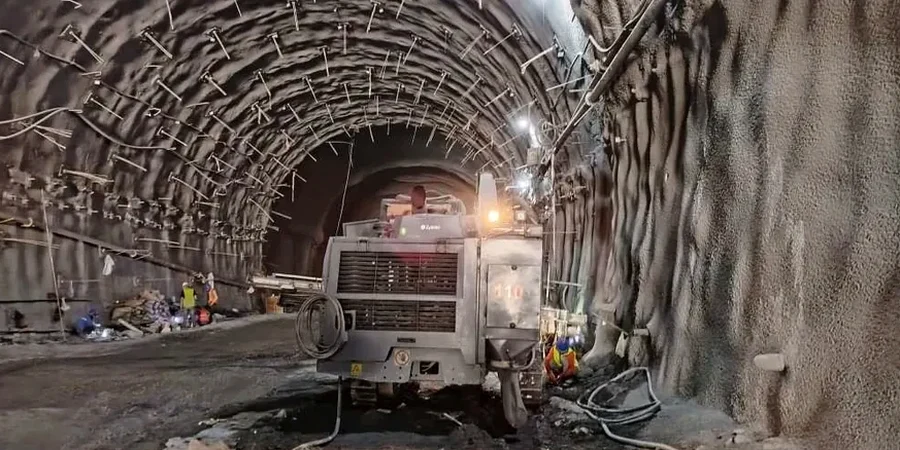
Methodology applied in Plymouth
Typical technical challenges in Plymouth
A recurring pattern in Plymouth is the contractor who trusts the limestone to stand unsupported for weeks, only to find that a three-day storm has flushed fines out of a dissolution feature behind the face. What starts as a trickle of sediment becomes a cavity, then a sudden loss of ground under the pavement. The risk escalates when excavations approach the intertidal zone: tidal pumping in the joints of the Plymouth Limestone can double the lateral earth pressure on a shoring system within a single tidal cycle. Monitoring must capture this hydraulic connection. If piezometers are installed only in the soil and not in the rock mass, half the water pressure story is missed. Similarly, temperature effects on inclinometer casings grouted in sun-exposed steel soldier piles can produce a false deflection signal of several millimetres that is easily misinterpreted as ground movement. The monitoring programme must include temperature correction protocols and, where possible, use twin-axis probes with built-in thermal compensation. Ignoring these local nuances leads to false alarms that erode site confidence or, worse, masks a genuine developing failure until it is too late to backfill or re-probe.
Our services
Our monitoring packages for Plymouth excavations are built around the specific ground profile at each site, from the limestone head deposits of the Hoe to the deep alluvium of the Plym valley. Every scheme includes an instrument commissioning report, baseline readings and a defined trigger action response plan (TARP) agreed with the designer before the first bucket enters the ground.
Deep Excavation Monitoring
Real-time inclinometer, piezometer and total station networks for basement digs and cut-and-cover tunnels across Plymouth's urban core, with automated SMS alerts tied to amber and red trigger values.
Retaining Wall Performance Verification
Strain gauge and load cell arrays on tie-back anchors and struts, combined with optical displacement monitoring, to confirm that sheet pile and secant walls perform within design deflection limits.
Tidal Groundwater Monitoring
Multi-level piezometer installations in the intertidal zone and adjacent to the Plym and Tamar estuaries, recording pore pressure response through complete spring–neap tidal cycles to calibrate dewatering designs.
Heritage and Adjacent Building Protection
High-precision tilt meters, crack gauges and vibration monitors deployed on listed buildings and sensitive structures within the zone of influence, with weekly condition survey reports for planning compliance.
Quick answers
What does a typical excavation monitoring plan cost in Plymouth?
Monitoring schemes in Plymouth generally range from £610 for a short-term, single-instrument installation on a shallow trench to £2,230 for a comprehensive package covering a deep basement with automated total stations, multiple inclinometers, piezometers and daily reporting over several months. The final figure depends on the number of instruments, the monitoring duration and the reporting frequency agreed with the design team.
How are trigger values set for Plymouth's ground conditions?
Trigger values are derived from the serviceability limit state calculations in the temporary works design, then calibrated against the site-specific ground model. Green, amber and red thresholds are assigned for each parameter: lateral deflection, settlement, groundwater level and vibration. Because Plymouth's estuarine clays can creep under constant load, the rate of change is often as critical as the absolute value, and the TARP defines specific actions for each alert level.
Can the monitoring system detect problems before they are visible at surface?
Yes. Inclinometers can capture sub-millimetre shear displacements at depth days or weeks before a scarp appears at ground level. Piezometers record pore pressure increases that precede basal heave in soft clays, giving the site team time to adjust dewatering or install additional propping. The whole purpose of instrumentation-led monitoring is to provide early warning, not simply to document a failure after it occurs.
How does tidal fluctuation affect excavation monitoring in Plymouth?
In areas like Millbay, Sutton Harbour and the Plym estuary, the water table can oscillate by over a metre between low and high tide. This cyclic loading changes effective stress in the ground and can produce daily deflection cycles in retaining walls. Monitoring must run continuously through at least one spring–neap cycle to capture the full range, and piezometer data is corrected for barometric pressure and tidal lag to avoid misinterpreting a natural cycle as a developing failure. More info.