Plymouth sits on a geological crossroads where Devonian limestone meets Middle Devonian slates, creating one of the most varied subsurface profiles in the southwest. With a population nearing 264,000 and major regeneration projects reshaping areas like Millbay and Devonport, knowing what lies beneath the surface isn't optional—it's essential. Seismic tomography cuts through the guesswork. The method sends controlled seismic waves into the ground and maps their travel times to build a velocity model of the subsurface. Where boreholes only give point data, a seismic refraction survey connects the dots between them, revealing bedrock depth, fracture zones, and buried channels that conventional site investigation often misses. For projects near the Tamar Estuary or within the limestone belt running through the Hoe, this geophysical approach provides the continuous profile engineers need to design foundations with confidence.
Seismic tomography turns a handful of boreholes into a continuous subsurface profile—essential in Plymouth where limestone and slate geology changes across short distances.
Methodology applied in Plymouth
Typical technical challenges in Plymouth
BS 5930:2015+A1:2020 and Eurocode 7 (BS EN 1997-2:2007) set the framework for ground investigation in the UK, and Plymouth's karstic limestone demands strict adherence. The Devonian limestones underlying the Hoe and the city centre are prone to solution features—voids, caves, and enlarged fissures that develop over decades without surface expression. A building constructed above an undetected cavity faces differential settlement, or worse, sudden collapse. Standard borehole grids can miss these features entirely. A borehole spaced every 20 metres might land on solid rock while a two-metre-wide void sits halfway between them. Seismic tomography bridges that gap by imaging the velocity contrast between intact limestone and air- or clay-filled cavities across the entire survey line. The risk isn't hypothetical; historical mining for limestone and slate in the Plymouth area has left unmapped workings that occasionally surface during construction. Combining tomographic imaging with a desk study of historical mine plans gives the fullest picture of what the ground really holds.
Our services
The seismic tomography service covers two complementary techniques suited to different site conditions across the Plymouth area. Each survey is designed around the specific geological target—whether it's mapping bedrock rippability for a road cutting or detecting voids beneath a proposed building footprint.
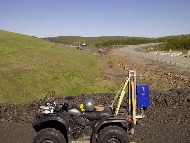
Seismic Refraction Tomography
Ideal for mapping bedrock depth, rippability, and the thickness of weathered zones. A linear geophone array records refracted waves that travel along the bedrock interface. Processing generates a continuous velocity model showing the transition from soil to weathered rock to competent bedrock. Frequently used for road alignment studies, foundation design, and quarry assessment across Plymouth's slate and gritstone formations.
Seismic Reflection Profiling
Higher resolution than refraction and better suited for detecting voids, cavities, and subtle stratigraphic changes within the limestone. Uses a tighter geophone spacing and processes reflected energy from acoustic impedance contrasts. Applied extensively in Plymouth's limestone belt for pre-construction risk assessment and karst feature mapping where building over undetected voids carries serious structural consequences.
Quick answers
How deep can seismic tomography see in Plymouth's geology?
For refraction surveys, the rule of thumb is roughly one-fifth to one-quarter of the spread length—so a 100-metre line can image down to about 20–25 metres reliably. In Plymouth's limestone, competent bedrock velocities are high enough that a 120-metre spread can reach 30 metres or more. Reflection surveys can go deeper, sometimes 50 to 100 metres, depending on the seismic source energy and the acoustic contrast between layers.
What does a seismic tomography survey cost for a typical Plymouth site?
For a standard seismic refraction survey with a single 100-metre line and 24 geophones, prices typically fall between £2,310 and £4,160. The final figure depends on line length, number of spreads, terrain accessibility, and whether reflection processing is also required. Sites with dense vegetation or steep slopes—common along the Plym valley—add setup time and may push costs toward the upper end.
How long does fieldwork and reporting take?
A single seismic line can usually be acquired in half a day on site, assuming reasonable access. Processing and interpretation take another three to five working days. For multi-line surveys covering larger footprints—like a full commercial development site—fieldwork may run two to three days, with reporting delivered within two weeks. We provide preliminary bedrock profiles within 48 hours if the programme is time-critical.
Do you need traffic management for roadside surveys in Plymouth?
It depends on the location. Surveys along classified roads such as the A374 or A386 require a traffic management plan and lane closure permits from Plymouth City Council, which we coordinate as part of the project. For minor roads and residential streets, a banksman and signage are often sufficient. Access constraints around Sutton Harbour and the city centre can also require early planning due to pedestrian density and narrow lanes. More info.